
Email Us
contact@destinationhimalayatreks.com
Viber/Whats App 
+977-98510 16814 (Min Gurung)+977-98511 46814 (Tara Rana)
Manaslu Circuit Trek 13 days
$999 per Pax
Overview
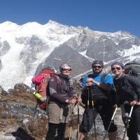
Manaslu Circuit Trek the eighth highest mountain, Mt. Manaslu 8,163 meter in the world providing us an opportunity to explore the colorful cultures having high Tibetan influence and navigate through the dramatic valleys against a fabulous background of classic snow-capped mountains, beautiful trails, and hospitality of the indigenous community along the trail. In this trek, we pay a visit to and pass through culturally rich and traditionally affluent Buddhist monasteries adorned with invaluable arts and architecture while walking through refreshing forests and settlements, covering six climatic zones and being up close and personal with the Manaslu Peak from larger sections along the way. Crossing Larkya La Pass, witnessing diversity in topography, flora, fauna, landscapes, culture, and traditions, savoring unique cuisines, awesome views of the Himalayas are highlights, and observation of the unique side of Nepal from the spots of this trail are some of the other highlights of this trek.
Manaslu Circuit Trekking Route
One of the most scenic and cultural treks The Manaslu Circuit Trekking begins as we take a drive from Kathmandu to Machhekhola, the starting point of our trekking activity. We ascend towards Liding, crossing beautiful suspension bridges and enjoying an overall experience of walking through the forest with culturally affluent Gurung villages along the way. We keep pushing ourselves towards several ups and downs in this ancient salt trading route for trade in Tibet and cross through the cultural villages of Jagat, Deng, Ghap, Lho, Samagaon, and Samdo. Overnight staying at Dharamshala just the lap of Larkey La Pass, 5140 meter could be difficult for breathing as you are already in height of 4,400 meter and air is this in this height.
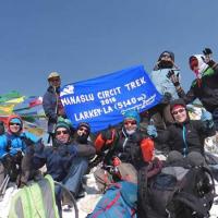
We leave Dharamsala behind and cross the highest altitude of our trip, the challenging long pass Larkya La Pass (5140m) for excellent views of Annapurna Himalayan Range, Cheo Himal, Himlung Himal, Kangaru peak with other neighboring snow-capped Himalayas. Furthermore, we trail back along the trail through the villages of Bhimtang, Tiliche, Tal, and Bhulbhule before we drive back to Kathmandu. Intermittently, we explore the lush valleys and green meadows, Buddhist monasteries, prayer flags and Mani walls, serene lakes, rivers, and waterfalls along with interaction with the locals for insight into the rich cultural legacy of the Gurung and Magar community. Please watch trip video https://youtu.be/ikplx9W9960
Best Season For Manaslu Trek
This Manaslu Circuit Trek is best recommended during the spring and autumn months of March, April, May, September, October, November, and December. Weather in Manslu region is mostly perfect during this time, but you never know the weather and climate changing in mountain.
If you are the trekker searching for solitude on the trekking trail and looking for the wilderness along with the unspoiled cultural ensembles, Manaslu Circuit Trek suits you the best. This is similar to the Annapurna Circuit years back: full of wilderness and authentic villages with well-preserved culture and yet untouched by the ills of development. Get inspired by the Himalayan lifestyle, leave nothing behind except good memories and get the best out of the visit to the land of the Himalayas. Join Destination Himalayas Treks and Expedition Pvt. Ltd. a leading trekking company in Nepal, for expert service and the best serving team.
Manaslu Conservation Area Project
Manasalu Conservation Area is located in a mountain region in the Gorkha district which is one of the most protected areas in Nepal and covers 1,663 km square. While trekking through this conservation area, we’ll pass through several local villages, terrain fields, picturesque landscapes, and diverse flora and fauna and the most amazing part is the area comprises beautiful mountains and glaciers that uplift the soul of the visitors.
Throughout, the journey we may also catch a glimpse of the Himalayan wild animals such as mountain deer, wild boar, and many more until we reach Larkey La. The Manasalu circuit is a perfect blend of natural beauty, cultural places, and spiritual significance that attracts many visitors to begin their journey for Manasalu Trek.
Annapurna Conservation Area
Annapurna Conservation Area is the most protected area in Nepal famous for its biodiversity and the house of more than a thousand flowering plants, mammals, birds, and animals, the area covers Manang, Myagdi, Mustang, Kaski and Lamjung. It soars at an elevation of 790 meters covering 7,629 square kilometers and became a famous trail for many base camps of the Nepal.
These areas are protected by the National Trust for Nature Conservation.
- Experiencing solitude in trekking experience along this less-visited trail
- Breathtaking view of the majestic Mount Manaslu and neighboring peaks from major sections of the route
- Enough time to acclimatize
- Walking from lush subtropical vegetation to the alpine vegetation
- Exploring the coexistence of Tibetan influenced Buddhism and strong Hindu faith
- Picturesque landscapes and rich architectural, traditional, and cultural heritages
Short Itinerary
Day 01: Take a bus to Arughat and change local jeep to Machhe Khola, 870 meter - 2531 feet (8 hours)
Day 02: Macchekhola to Yarubagar, 1350 meter - 4496 feet (5-6 hours)
Day 03: Yarubagar to Fillim Village, 1570 meter - 5,233 feet (6-7 hours)
Day 04: Fillim to Deng, 1860 meter - 6,200 feet (6-7 hours)
Day 05: Deng to Ghap, 2165 meter - 7210 feet (6-7 hours)
Day 06: Trek from Ghap to Lho, 3180 meter - 10,590 feet (6-7 hours)
Day 07: Lho to Samagaun, 3525 meter - 11,738 feet (5-6 hours)
Day 08: Samagaun to Samdo, 3860 meter - 12,854 feet (4-5 hours)
Day 09: Acclimatization day
Day 10: Samdo to Dharamsala, 4460 meter - 14,852 feet (3-4 hours)
Day 11: Dharamsala-Larkya La Pass 5140 meter - 17,116 feet to Bhimtang 3610 meter 12,021 feet (9-10 hours)
Day 12: Bhimtang to Tilche, 2300 meter -7,659 feet (6-7 hours) to Dharapani, 1860 meter - 6194 feet
Day 13: Take a jeep sharing or bus ride to Besishahar, 760 meter and bus to Kathmandu
Includes
All land transportation as required for the trip
Food- 3 major meal a day and accommodation during the trek
Manasalu restricted permit, Manaslu Conservation Park Permit and Annapurna Conservation Park Pemit, TIMS permit
Tea or Coffee with breakfast
Insurance for guide and porters
Emergency evacuation service if in case needed
Excludes
Bar bills and beverages
Personal trekking gears
Rescue charge if needed
Tips to guide and porters
Detail Itinerary
-
Day 01: Take a bus to Arughat and change local jeep to Machhe Khola, overnight lodge
Today your trekking trip will begin, so your guide will come hotel to pick and go together to bus station for Arughat. Bus leaves in the morning at 7:00 am and it takes about 8-9 hours to reach Machhekhola. There is no tourist bus to Arughat, so you will travel by public transportation to Arught and the change another vehicle to Machhekhola takes about 2 hours. Bus will stop on the way for breakfast for half an hour. Bus journey to Arughat - Machhekhola is amazing. You will mostly be drove through riverside. On the clear sky day you will have white Himalaya during this travel. Today you may tired with bus journey, early bed would be ideal.
-
Day 02: Macchekhola to Yarubagar, 1350 meter - 4496 feet (5-6 hours)
Machha Khola is a village perched on the hill slope with comfortable accommodation arrangements; however, camping is another option preferred by trekkers. After the view of Ganesh Himal from Machhekhola, we further to Khorlabesi after meeting the trail from Barpak before we cross the suspension bridge. Rocky trails continue to accompany us beside the roaring Budhi Gandaki River. Past another viewpoint of Ganesh Himal, we reach a tiny point of Tatopani, renowned for the hot water in the village square. Squeezed in between the torrential Budhi Gandaki and tremendous cliff, Tatopani may have you experience the echo of roaring landslides. Ahead of this settlement, we have some waterfalls, suspension bridges, and the villages of Dobhan before we reach our destination of Yarubagar. Overnight in Yarubagar.
-
Day 03: Yarubagar to Fillim Village, 1570 meter - 5,233 feet (6-7 hours)
Further along the trek, we continue along the trail past the long suspension bridge to reach stone-paved trails in Jagat. These slate-paved streets of Jagat are impressive. You will also have your MCAP (Manaslu Conservation Area Project) permit checked at the MCAP office in Jagat and you may learn about MCAP activities. From Jagat we descend to the beautiful village of Salleri and quickly to another village of Primo, affected by a landslide a few years back. We reach other compact villages of Sardinas with stone houses and slate roofs. Past the village of Ghate Khola and suspension bridge, we have a steep climb to Philim. Overnight in Fillim.
-
Day 04: Fillim to Deng, 1860 meter - 6,200 feet (6-7 hours)
Today we shall cross the Budhi Gandaki River a couple of times before we reach our destination. We move through the highlighted spot of Ekle Batti, a large Gurung village, and part our ways off the trail to Tsum valley ahead of Lokpa before we reach the village of Nyack. The pines decorating the trail after Ekle Bhatti contrasting with the tropical vegetation down at the lower altitude show richness of the trail. We ascend the milder climbing past the narrow gorge, through the suspension bridges, bamboo, rhododendron, and pine forest have an easier descent along one of the branches of Budhi Gandaki to reach the destination of Deng. Along the trail, we observe mesmerizing waterfalls, beautiful gorges with towering walls alongside, and the views of mountains including Ganesh Himal IV. Overnight in Deng.
-
Day 05: Deng to Ghap, 2165 meter - 7210 feet (6-7 hours)
Today we mostly walk through the farming land and pass beautifully settled cultural villages, suspension bridge, local people and their way of living. We will encounter porters carrying very heavy and the donkeys doing their job throughout the trekking, donkeys are used as porters in Himalaya region. You will have a great day today, overnight in ghap.
-
Day 06: Trek from Ghap to Lho, 3180 meter - 10,590 feet (6-7 hours)
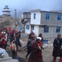
Today is another beautiful section of the trekking expedition. We move ahead of Ghap only to find dense and beautiful forests decorated with fir, rhododendron, bamboo and oaks, and other alpine vegetation along the way. With occasional steep trails and streams along the way, we reach the village of Namrung past a couple of suspension bridges and stone stairs. Ahead of the village, the landscape opens up to extensive barley fields. We navigate through the village with unique architecture, Lihi, cross a large stream with its source in the Lidanda Glacier, and reach the Tibetan-style village of Sho along with the view of Simnang Himal (6251m). A couple of hours of trekking leads us to the village of Lho. Lho is a beautiful and culturally rich village adorned with ancient Buddhist monasteries decorated with prayer flags, chorten, Mani walls, and several stupas besides the bigger Nyingma Rimjung gompa. The view of twin-peaked Manasalu and the majestic Ganesh Himal makes this landscape further beautiful. Overnight in Lho.
-
Day 07: Lho to Samagaun, 3525 meter - 11,738 feet (5-6 hours)
Decorated with rich Buddhist cultural ensembles, Lho bids us adieu as we move to ascend ahead through the quite beaten forest towards the other settlement of Shyala. With significant agricultural activity, the village of Shyala is also engaged in the construction of wooden houses presumably aimed at making it a resting place. We march ahead on the trail crossing the slopes that drain the Punggen glacier and reaching the nice flat area that hosts the lovely village of Samagaun. With properly aligned houses with beautiful courtyards and fields located on both sides of the village, Samagaun is busy during the season of the Manasalu climbing expedition as it is the closest village to the Manaslu Base camp. Overnight in Samagaun.
-
Day 08: Samagaun to Samdo, 3860 meter - 12,854 feet (4-5 hours)
The trail today to Samdo village turns to the north on the upper region of the Budhi Gandaki River. Following the gradual ascends, we pass through the point of confluence of Larke river and the river formed due to Samdo glacier, also the origin of the torrential Budhi Gandaki and we reach the settlement at Samdo. Before that we leave the trail to Manaslu Base Camp to our left and ahead of the point where we part from the trail to Manaslu Base Camp, we pass through the beautiful juniper and birch forests of Kermo Kharka. We march ahead through wooden bridges and steep climb onto the headland from where a large white Kani can be viewed. Past the Kani, we reach our destination for today. Overnight in Samdo.
-
Day 09: Acclimatization day
Today is an acclimatization day. We explore the lovely Samdo village with several points to explore. Samdo is located just under the majestic Samdo peak and Samdo glacier. One side trip from Samdo is to the Tibetan border of Rui La either through the Lajyung pass or through the Rui La pass which is the main route path. We can also hike to the valley at the back of the valley past the seasonal herding settlements, flora, and fauna and the views of peaks such as Mt Manasalu, Simrang, Hiuchuli, Larkye peak, Cheo, Ngadi along the way. Another available option is the hike to the longer route to Gya La. Overnight in Samdo.
-
Day 10: Samdo to Dharamsala, 4460 meter - 14,852 feet (3-4 hours)
The trail from Samdo to Dharamshala is a relatively shorter section of our trekking experience. We move along the trail through the Athahra Saya River and along the Larke River. We pass through the Taka Choeling Gumba, with the view of Naike and Pangboche Peak, and climb gradually along the trail. We cross a bridge and move past the Mani walls and stone huts to reach the Larkya Bazaar, a settlement that hosts accommodation sites as well. We reach the highest point before the Larke pass, Dharamshala or Larke Phedi with the place to set up campsites and structures. Along the way we also have a view of Syacha Glacier, grazing land, beautiful forests, lichened stones and keep an eye for the Blue sheep. After reaching Dharamshala we may optionally hike around the ridges of the village. Overnight in Dharamshala.
-
Day 11: Dharamsala-Larkya La Pass 5140 meter - 17,116 feet to Bhimtang 3610 meter 12,021 feet (9-10 hours)
Get ready for some strenuous activity today as we shall cross over the Larkey Pass (5140m) to reach Bhimtang. We set off early in the morning for a long trek today. After a short climb, we reach the north of the Larkya Glacier, into a valley that provides spectacular views of Cho Danda and Larkya Peak. Further, we march across the moraines, make a slow climb initially, and steeper into the last section of the Larkey La pass. The view from the top of the pass includes the Samdo Peak and other peaks bordering Tibet, Larkya peak to the southeast, the Annapurna region along with several mountains, and a bit further down to the west for the view of Annapurna II. We have a steep descent on the slippery path out of the Pass following the trail to the left of Saludando glacier moraine. Past the grassy moraine and rockfall area, a flatter valley with primulas and azalea bushes we reach the sandy plain of Bhimtang. Overnight in Bhimtang.
-
Day 12: Bhimtang to Tilche, 2300 meter -7,659 feet (6-7 hours) to Dharapani, 1860m - 6,194 feet (7 hours)
Bhimtang is a region used by the Samdo people as a place to keep their yaks and horses in the summer and winter months. We traverse along the magical trail to the south of Bhimtang after we have the views of Lamjung Himal, Himlung Himal, Manasalu, and Cheo Himal from a ridge at Bhimtang. After we cross pasture and bridge, we navigate through the rhododendron forest, further through a narrow valley, and reach the valley at Karache. Along the rocky riverbed and on the trails on hillsides we pass through the small and lush villages signifying the lower altitudes. Further ahead we reach the village of Tilche and continue trek to Dharapani, trekking trail to Annapurna Circuit Trek with Thorong La Pass
-
Day 13: Take a jeep sharing or bus to Kathmandu via Besisahar, 760 meter - 2531 feet (8 hours)
We will see what kind of vehicle find for Besisahar either public bus or jeep sharing to Besishahar. As there is no tourist bus available you will take a public bus or public Haice Van to Kathmandu which take about 5 hours. After driving about 2 hours you will join the main High Way Kathmandu-Pokhara. If you are travelling in the main trekking season Spring or Autumn, the road condition is good all the way to Kathmandu from Besisahar. Your booked or bought trekking package ends today
-
More travel information about this trekking
Accommodation
Accommodations in the Manaslu region are mostly locally operated teahouses/guesthouses. A simple room with basic facilities but comfortable at the same time. In the lower regions, one can get a room with an attached bathroom too. But at the higher region and the peak seasons, room sharing must be done. The bathroom is also outside in the higher region. One must pay an additional amount to use the electricity, Wi-Fi, laundry, and hot bucket water.
Meals
The 3-course full meals are served during the entire trek in the Manaslu region. Since the Manaslu region is remote, don’t expect to get all types of meals. The meals are simple but with good energy portions for the trekkers to trek. Nepali Dal-Bhat is a good energy source for trekkers. Besides this, noodles, soups, fresh green vegetables, hot tea, etc. are served. The region of this people believes in Buddhism and doesn’t kill animals. So, there is the least chance of getting meat products. It is always a good idea to carry some light snacks and choco bars with you.
Drinking water
Drinking water in the Manaslu region is easily available. One can fill up the water at the teahouses paying an extra amount or purchase bottled water. It is convenient to carry a water bottle and water purifying kits for safety.
Communication
The internet connectivity and phone networks are stable in the lower regions whereas it is hard to find the networks in the higher Manaslu region. For the use of Wi-Fi, pay an additional charge at the teahouses or purchase a local sim with a data pack. And for emergencies, there is a satellite phone facility.
Transport
Manaslu region is an off-beat trekking trail. Hence, the trails are not much developed compared to the Annapurna region. There is no airway transport facility like the Everest region since this region has no airport. One and the only best means of transport in this region is a public vehicle or private jeep ride to Soti Khola.
Starting and Ending points
The starting point is Arughat and the ending point is Besisahar.
Manaslu Region Required Permits
We require Restricted Area Permits, Manaslu Conservation Area Permit, and Annapurna Conservation Area Permit for the Manaslu region trek.
Trekkers traveling to Tsum valley only require Tsum Valley RAP and MCAP. Other Manaslu region trek only acquires MCAP, ACAP, and Manaslu RAP.
The required permit costs are as follows:
Manaslu Restricted Area Permit
USD 100/week per person + USD 15/person (each day after a week) [Sep-Nov]
USD 75/week per person + USD 10/person (each day after a week) [Dec-Aug]Manaslu Conservation Area Permit (MCAP)
Foreigners- USD 30/person
SAARC- NPR 1000/person
Annapurna Conservation Area Permit (ACAP)Foreigners- USD 30/person
SAARC- NPR 1000/person
Tsum Valley Restricted Area Permit
Travel Insurance
Travel Insurance is very helpful and a safety net for travelers/trekkers. Travel Insurance must cover all medical emergencies, flight cancelations, emergency evacuations, loss of luggage, and altitudes over 3000 m.Safety and our guides
We assure you 100% when it comes to safety. Our client’s safety is our main concern. Our guides are certified and well-trained with years of expertise in this field. They are technically competent and have excelled in safety performance. They always carry essential safety equipment, gear, and first-aid kits. For the safety of our trekkers, the itinerary is properly scheduled and acclimatization rest days are properly set up to adjust to the high altitude and prevent altitude sickness. If any queries concerning safety, feel free to share them with our guides. We are always there for your services.Best time for Manaslu Region Trek
Spring (Mar-May) and Autumn (Sep-Nov) seasons are the best time followed by the summer season for the Manaslu region Trek. The weather is clear and sunny during these seasons. Despite the trail being off-beat and rough, the trail is comfortable to walk. Rainy and Winter season treks are not recommended and are only for experienced trekkers. Only a few adventurous trekkers dare to trek during these seasons. During these seasons, the trails are slippery, muddy, and snowy. Also, the availability of accommodation is very less. So, we recommend you plan carefully if you want to trek during the off-season.Manaslu Region Trek Difficulty
Manaslu region being remote, the trek is challenging. The trails are least developed, off-beat, and rough. There are several ascend and descend which makes it tougher for trekkers to trek. Besides this, high elevations, change in climate, and unavailability of all major facilities are other factors that make this trek difficult. But, with proper planning and assistance before the start of the trek, this Manaslu region trek is possible. We recommend you participate in exercises, day hikes, and physical training months before starting the trek. Also, take necessary health tests before trekking to high altitudes. You can completely trust our assistance and guidelines throughout the trekking journey.Acclimatization and Altitude Sickness
Acclimatization rest is necessary during trekking. So, try to properly utilize the acclimatization rest days and do some short hikes and explore nearby places. It helps prevent altitude sickness and adapt to the environment. Altitude sickness in the mountains is normal. It can happen to anyone. By acknowledging its symptoms and with accurate preventive guidelines, altitude sickness can be cured.Symptoms of Altitude Sickness
Primary: Headache, nausea, gasping, appetite & sleep loss, dizziness, fatigue, vomiting
Extreme: primary symptoms and hallucinations & unconsciousness
Preventive Guidelines
Immediately inform the guide
Warm-up, up and body stretch before the trekking journey
Drink water and Hydrate yourself at regular intervals
Frequent urination throughout the journey
Ascend slowly and gradually
Take plenty of rest and sleep
Avoid salty foods, alcohol, and smoking
Descend immediately when it’s difficult/uneasy
Take medicine consulting a guide
Shoes: Pair of hiking boots, Rubber sandals
Clothes: Windcheater jacket, Thermals, Down Jacket, Fleece, Long sleeve shirts, Gloves, Towels, Inner garments, Trekking pants, Trousers, Shorts, Socks
Accessories: Sunglasses, Ski Goggles, Hats/Caps, Beanie, Sunscreen, Lip Balm, Head Lamp, Pocket Knife, Personal Hygiene &Toiletries
Equipment: Warm Sleeping bags, Map, Trekking poles, Duffel bag
Medicine Kit: Wash Kit, First-Aid Kit, Blister Repair Kit, Medicines for preventing Altitude sickness, Prescribed Medicines (Personal use)
Rainy season: Waterproof clothes, boots, Raincoat, Anti-leech socks
Winter Season: Woolen clothing items (light)
Extras: Heat/Leak proof water bottles, Water Purifying solution (Iodine based), Water filters, Insulated cup/flask, Map, Binoculars, Travel Documents, Sewing kit, Cash, Extra batteries, Power bank, Pen, Diary, Book, Reusable (spoon, cup, plate), Reusable bags, Large Waterproof Disposable Bags, Snacks (Choco-bars, Mints, Nuts, Granola Bars)
It is best to bring the clothes and essential equipment from your home from the provided checklist. Also, you can buy or rent equipment and clothes in Kathmandu. You can customize the checklist as a necessity.


